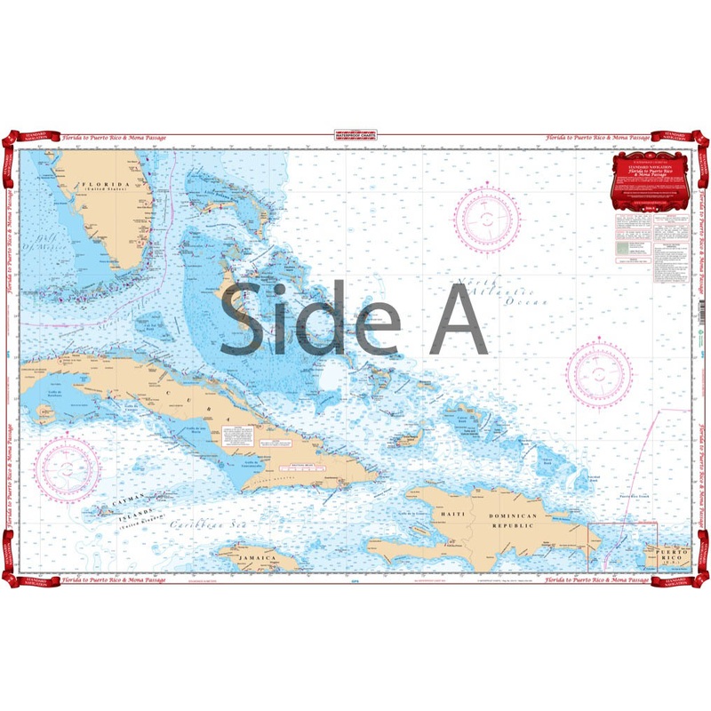
This offshore navigation chart shows the area from mid Florida to Western Puerto Rico on side A. Includes Hispanola, Turks and Caicos Islands, Jamaica, Cayman Islands and the entire Bahama chain. Side B covers Mona Passage, between Hispanola and Puerto Ric
Flash Sale Ongoing
This offshore navigation chart shows the area from mid Florida to Western Puerto Rico on side A. Includes Hispanola, Turks and Caicos Islands, Jamaica, Cayman Islands and the entire Bahama chain. Side B covers Mona Passage, between Hispanola and Puerto Rico, and shows the Island of Mona and the Mayaguez and Boqueron areas east to Ensenada. If you plan to head across the Florida Straits, youre in luck! These marine maps offer an overhead view from the tip of South Florida down to the Caribbean. This offshore navigation chart shows the area from mid Florida to Western Puerto Rico on side A. Includes Hispanola, Turks and Caicos Islands, Jamaica, Cayman Islands and the entire Bahama chain. Side B covers Mona Passage, between Hispanola and Puerto Rico, and shows the Island of Mona and the Mayaguez and Boqueron areas east to Ensenada. For those of you wishing you could have this navigation map framed on your wall, now you can with our custom framing service.
Reviews
There are no reviews yet.