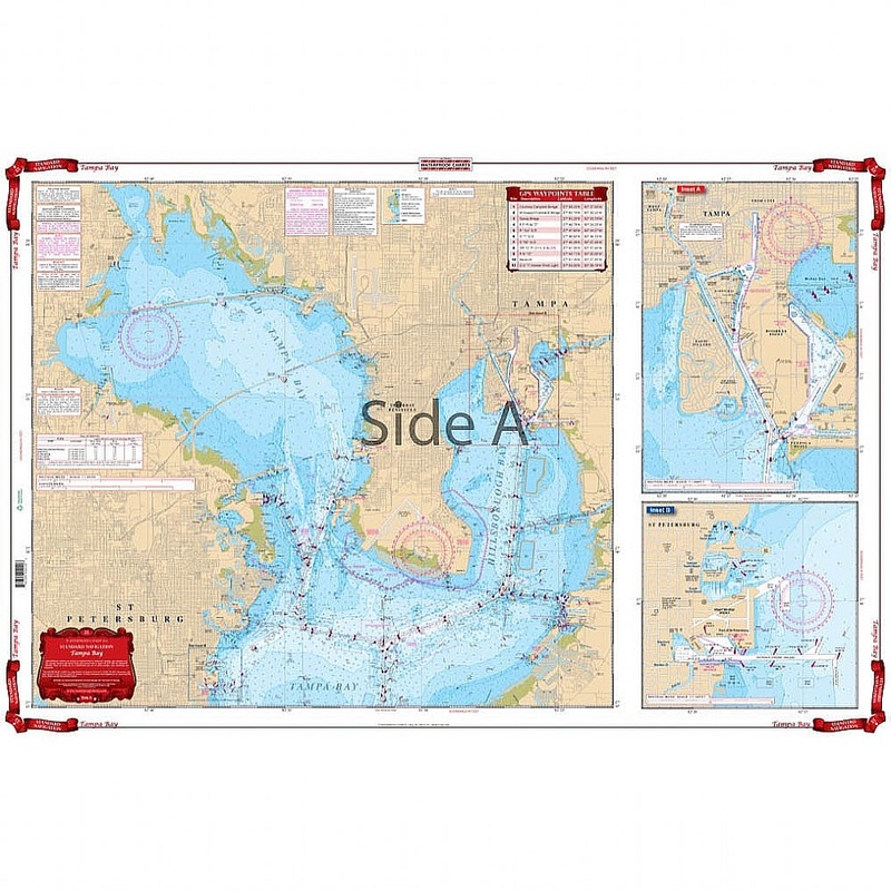
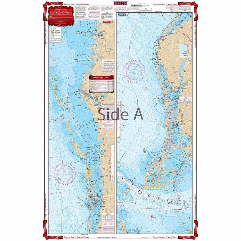
Best detailed coverage for both North and South Tampa Bay and to 10 miles offshore. Includes Manatee River to Interstate 75 Bridge as well as Boca Ciega Bay. Includes Old Tampa Bay. Has blown up detailed insets for St. Petersburg and Davis Island and Hooke
Flash Sale Ongoing
Best detailed coverage for both North and South Tampa Bay and to 10 miles offshore. Includes Manatee River to Interstate 75 Bridge as well as Boca Ciega Bay. Includes Old Tampa Bay. Has blown up detailed insets for St. Petersburg and Davis Island and Hookers Point. This Tampa Bay nautical chart is going to become your best friend while youre on the water. Whether youre in a kayak, on a paddleboard, or boating, your Waterproof Chart will stand up to the elements. We offer the best detailed coverage for both North and South Tampa Bay and to 10 miles offshore. This is because we take data from 2 NOAA charts to make sure you have the most detail possible. This nautical map also includes Manatee River to Interstate 75 Bridge as well as Boca Ciega Bay and Old Tampa Bay. Youll find convenient, blown up detailed insets for St. Petersburg and Davis Island and Hookers Point. We recommend you get two of these marine charts.
Reviews
There are no reviews yet.