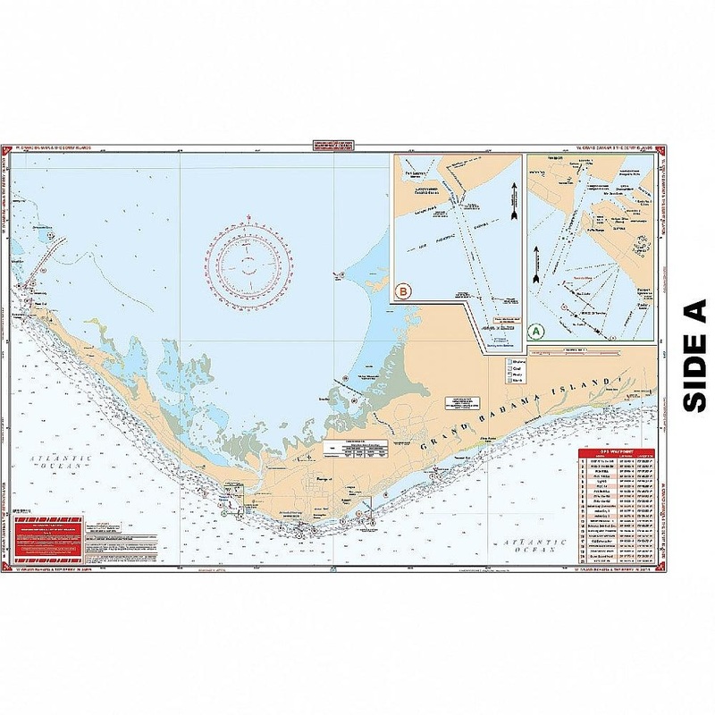
Detailed coverage for the west portion of Grand Bahama Island from the Missle Base east. Includes the Grand Bahama Waterway, all southside marinas and canals, and the Commercial Harbor. Waypoints are provided for all harbor entrances and for the Indian Key
Flash Sale Ongoing
Detailed coverage for the west portion of Grand Bahama Island from the Missle Base east. Includes the Grand Bahama Waterway, all southside marinas and canals, and the Commercial Harbor. Waypoints are provided for all harbor entrances and for the Indian Key Channel. An added red pattern details the south side barrier reef. Detail entrance diagram for Port Lucaya. The reverse side covers the Berry Islands in detail from Great Stirrup south to Chub Cay. Inside routes and shallow areas have been added with GPS Coordinates. Lights damaged by Hurricane Andrew have been noted.No trip to the Bahamas is complete without this Western Bahamas map. And were not just saying that. We have provided detailed coverage for the west portion of Grand Bahama Island from the Missle Base east. This navigation chart also includes the Grand Bahama Waterway, all southside marinas and canals, and the Commercial Harbor. Waypoints are provided for all harbor entrances and for the Indian Key Channel. An added red pattern details the south side barrier reef. There is also a detailed entrance diagram for Port Lucaya on this navigation map. The reverse side covers the Berry Islands in detail from Great Stirrup south to Chub Cay. Inside routes and shallow areas have been added with GPS coordinates. Lights damaged by Hurricane Andrew have been noted to assist with navigation.

Reviews
There are no reviews yet.