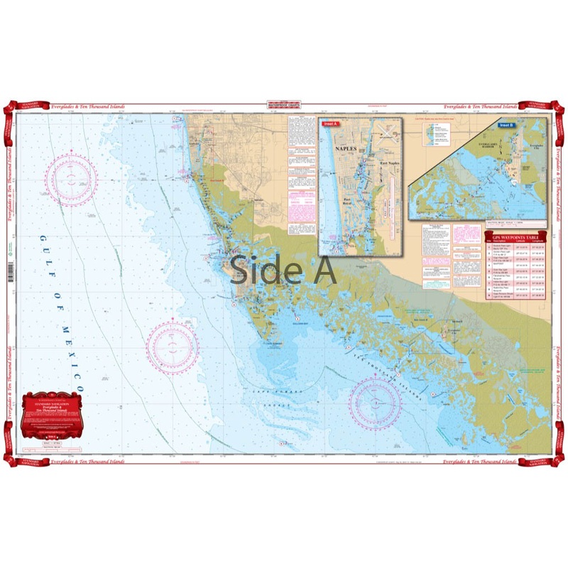
Coastal Coverage from Naples south, covering Cape Romano Shoals to Chatham Bend and Pavilion Key. Detailed Coverage for Naples and 10,000 Islands to Lostmans River, including the Everglades City and Chokoloskee Area. Complete details for the Wilderness Wat
Flash Sale Ongoing
Coastal Coverage from Naples south, covering Cape Romano Shoals to Chatham Bend and Pavilion Key. Detailed Coverage for Naples and 10,000 Islands to Lostmans River, including the Everglades City and Chokoloskee Area. Complete details for the Wilderness Waterway for small boaters and canoeists. (To complete this trip to Flamingo use chart #39). Southwest Florida is known as a boaters paradise. Our navigation map of the Everglades region to the Ten Thousand Islands is your guide to this beautiful Gulf Coast area. Coastal coverage runs from Naples south, covering Cape Romano Shoals to Chatham Bend and Pavilion Key. Detailed coverage for Naples and the Ten Thousand Islands to Lostmans River, including the Everglades City and Chokoloskee Area. Complete details for the Wilderness Waterway for small boaters, canoers, and kayakers.
Reviews
There are no reviews yet.