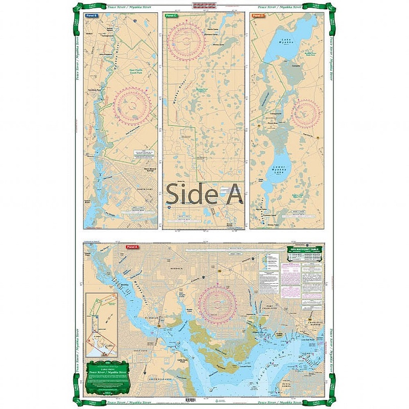
Covers the Peace River from Arcadia south to Charlotte Harbor and the Myakka River from Myakka River State Park. Depths from upstream of I-75 Bridge to Charlotte Harbor. Detail of North Charlotte Harbor south to Ponce DeLeon Park. Information from NOAA 114
Flash Sale Ongoing
Covers the Peace River from Arcadia south to Charlotte Harbor and the Myakka River from Myakka River State Park. Depths from upstream of I-75 Bridge to Charlotte Harbor. Detail of North Charlotte Harbor south to Ponce DeLeon Park. Information from NOAA 11426 and USGS maps and ISS field surveys. Colored Key. The Peace River and Mayakka River are wonderful places to kayak, camp, canoe, boat, and fish. To expertly navigate this area, we have the perfect nautical map for you. This navigation map covers the Peace River from Arcadia south to Charlotte Harbor and the Myakka River from Myakka River State Park. Depths are included from upstream of I-75 Bridge to Charlotte Harbor. Detail of North Charlotte Harbor south to Ponce DeLeon State Park.
Reviews
There are no reviews yet.