This great chart is all you need for the Panama City Area. Covers the West Bay, St. Andrew Bay, North Bay and East Bay areas east to Wetappo Creek, all on one side with GPS Waypoints printed directly on the chart. The reverse side covers the offshore area
Flash Sale Ongoing
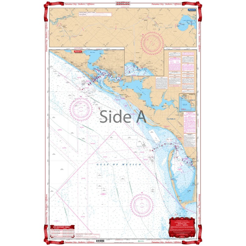
This great chart is all you need for the Panama City Area. Covers the West Bay, St. Andrew Bay, North Bay and East Bay areas east to Wetappo Creek, all on one side with GPS Waypoints printed directly on the chart. The reverse side covers the offshore area to south of Cape St. Blas and includes St. Joseph Bay and Port St. Joe and east to Gulf Resort Beach. The Intracoastal Waterway and Gulf County Canals are also shown from Searcy Creek west to meet the reverse side at Wetappo Creek, giving complete ICW coverage from Mile Marker 275 to Mile Marker 335. The offshore panel also features GPS Waypoints printed directly on the chart. No matter if you are a local, visiting for Spring Break, or boating through, you will want this Panama City map. This great navigation chart is all you need for the Panama City Area. It covers the West Bay, St. Andrew Bay, North Bay and East Bay areas east to Wetappo Creek, all on one side with GPS Waypoints printed directly on the marine map. The reverse side covers the offshore area to south of Cape St. Blas and includes St. Joseph Bay and Port St. Joe and east to Gulf Resort Beach. The Intracoastal Waterway and Gulf County Canals are also shown from Searcy Creek west to meet the reverse side at Wetappo Creek, giving complete Intracoastal Waterway coverage from Mile Marker 275 to Mile Marker 335. The offshore panel also features GPS Waypoints printed directly on the chart.
Reviews
There are no reviews yet.