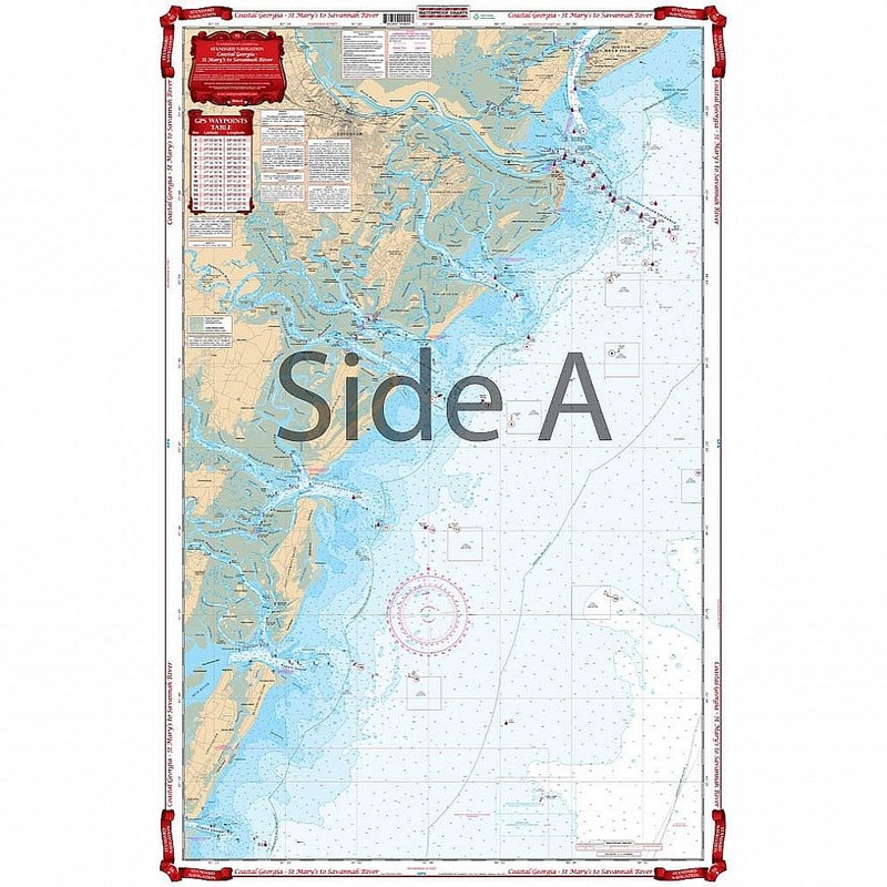
Covers the coastal area from Fernandina Beach, Florida north to Hilton Head, South Carolina and includes all of Georgias coastal waters, sounds and river mouths. Covers St. Andrew Sound, St. Simons Sound, Altamaha Sound, Doboy Sound, Sapelo Sound, St Cathe
Flash Sale Ongoing
Covers the coastal area from Fernandina Beach, Florida north to Hilton Head, South Carolina and includes all of Georgias coastal waters, sounds and river mouths. Covers St. Andrew Sound, St. Simons Sound, Altamaha Sound, Doboy Sound, Sapelo Sound, St Catherines Sound, Ossabaw Sound, the Savannah River Entrance, and Calibogue Sound. Coverage 10 to 25 miles offshore. A total of 26 plotted GPS Waypoints. Georgia boaters and fishermen need this nautical map on their vessels. Besides being able to plan trips, this navigation chart is also excellent for tracking hurricanes. It covers the coastal area from Fernandina Beach, Florida north to Hilton Head, South Carolina and includes all of Georgias coastal waters, sounds and river mouths. There is also detailed coverage St. Andrew Sound, St. Simons Sound, Altamaha Sound, Doboy Sound, Sapelo Sound, St Catherines Sound, Ossabaw Sound, the Savannah River Entrance, and Calibogue Sound. Coverage runs 10 to 25 miles offshore. A total of 26 plotted GPS Waypoints will help you locate places of interest.
Reviews
There are no reviews yet.