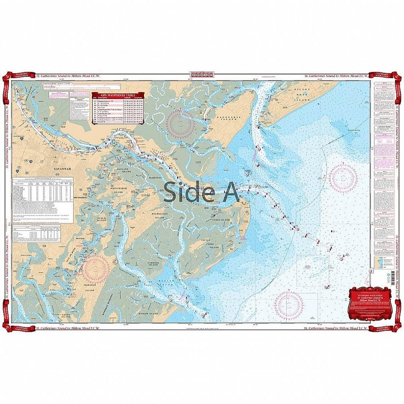
From Hilton Head south to St. Catherines Island, this chart covers the inside and coastal waters to approximately 7 miles offshore. Covers the Savannah River from the mouth to upstream of Savannah at Port Wentworth. Covers Whitemarsh and Tybee Island and s
Flash Sale Ongoing
From Hilton Head south to St. Catherines Island, this chart covers the inside and coastal waters to approximately 7 miles offshore. Covers the Savannah River from the mouth to upstream of Savannah at Port Wentworth. Covers Whitemarsh and Tybee Island and south to the Wilmington River. The reverse side continues south, with a complete view of Ossabaw Sound, the Bear River and southto the North Newport River and St.Catherines Island. Gives complete coverage of the IntraCoastal Waterway. Whether you are new to this area or a local, you will get tons of use from this Hilton Head map. From Hilton Head south to St Catherines Island, this navigation chart covers the inside and coastal waters to approximately 7 miles offshore. This nautical map also covers the Savannah River from the mouth to upstream of Savannah at Port Wentworth. As well as, Whitemarsh and Tybee Island and south to the Wilmington River. The reverse side continues south, with a complete view of Ossabaw Sound, the Bear River and southto the North Newport River and St Catherines Island.
Reviews
There are no reviews yet.